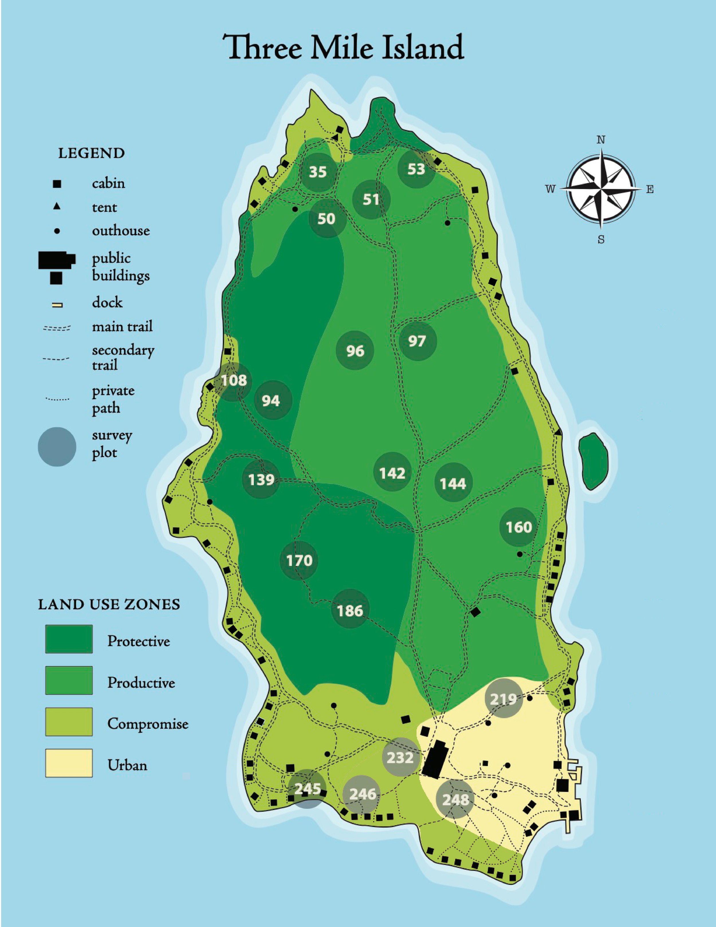
Land Use Zones
In order to balance recreation and preservation, Three Mile Island has adopted a land use plan to guide current use and to plan for future use. Four types of zones define how land on various parts of the island are to be developed or preserved. The below map identifies what areas of the island are in each zone, using the following definitions:
1) Protective Areas that contain unusual vegetation or natural formations and are generally undeveloped. Areas designated under this category will have no buildings or structures, forestry or wildlife management activities. Hazardous trees and other vegetation may be cut and trails maintained for safe and enjoyable camper experiences. These areas are most restricted from further development.
2) Compromise Areas that contain walking trails and mid densities of buildings as well as designated activity areas (retreat, fire pits, and storage areas). Areas designated under this category will have no new buildings or structures (other than replacement). Trees and other vegetation may be cut to maintain vistas and to protect buildings, trails and designated activity areas. Shoreline vegetation should be protected to the fullest extent possible.
3) Productive An area that contains productive soils and a low density of buildings, trails and designated activity areas (volleyball court, tower/tower storage area) where forestry and wildlife management activities may occur. The primary objective for cutting trees and other vegetation is for the production of firewood and enhancement of wildlife habitat. Trail maintenance and replacement of buildings and structures can occur within this area.
4) Urban An area that contains a high density of trails, buildings, recreational facilities and designated activity areas (horseshoe pit, dock area, tennis court, main house, store/office and other areas/buildings required for facility maintenance) that support the highest level of camper use and staff activities. Tree cutting, vista clearing, trail maintenance and replacement/renovation of buildings and structures can occur within this area; however, shoreline vegetation should be protected to the fullest extent possible.
Vegetation Study
Three Mile Island campers feel restored, renewed and refreshed by their immersion in the island community. Maintaining that experience requires effective land stewardship involving sustainable use and careful management. This introduction and slide show (PowerPoint version) (PDF version) are meant to invite the TMI community to share that stewardship by learning more about a significant study and the land use plan.
The TMI community has been fortunate to have three of its members involved in an ecological study to identify the plants that make up and dominate the flora of Three Mile, Hawks Nest, and Blueberry islands. For forty years Marge Holland (plant ecologist), Bat Clapham (statistician) and Jay Maciejowski (forester) have been measuring the impacts of campers and management practices on changes in island plant species abundance and diversity. The studies' results have been published in peer-reviewed US and international scientific journals as well as AMC publications, and have been presented at professional scientific meetings.
The data demonstrates that the TMI land use plan is preserving the character of the island and minimizing the impacts of recreational use. The results also show an increase in plant diversity, indicating a healthy ecosystem.
Plot points for the study are on indicated on the above map by numbered circles. You can learn more about the history of botany study on Three Mile Island in this 2021 AMC Outdoors article: 120 Years of Botany, Discovery and Surveying at AMC's Three Mile Island Camp.
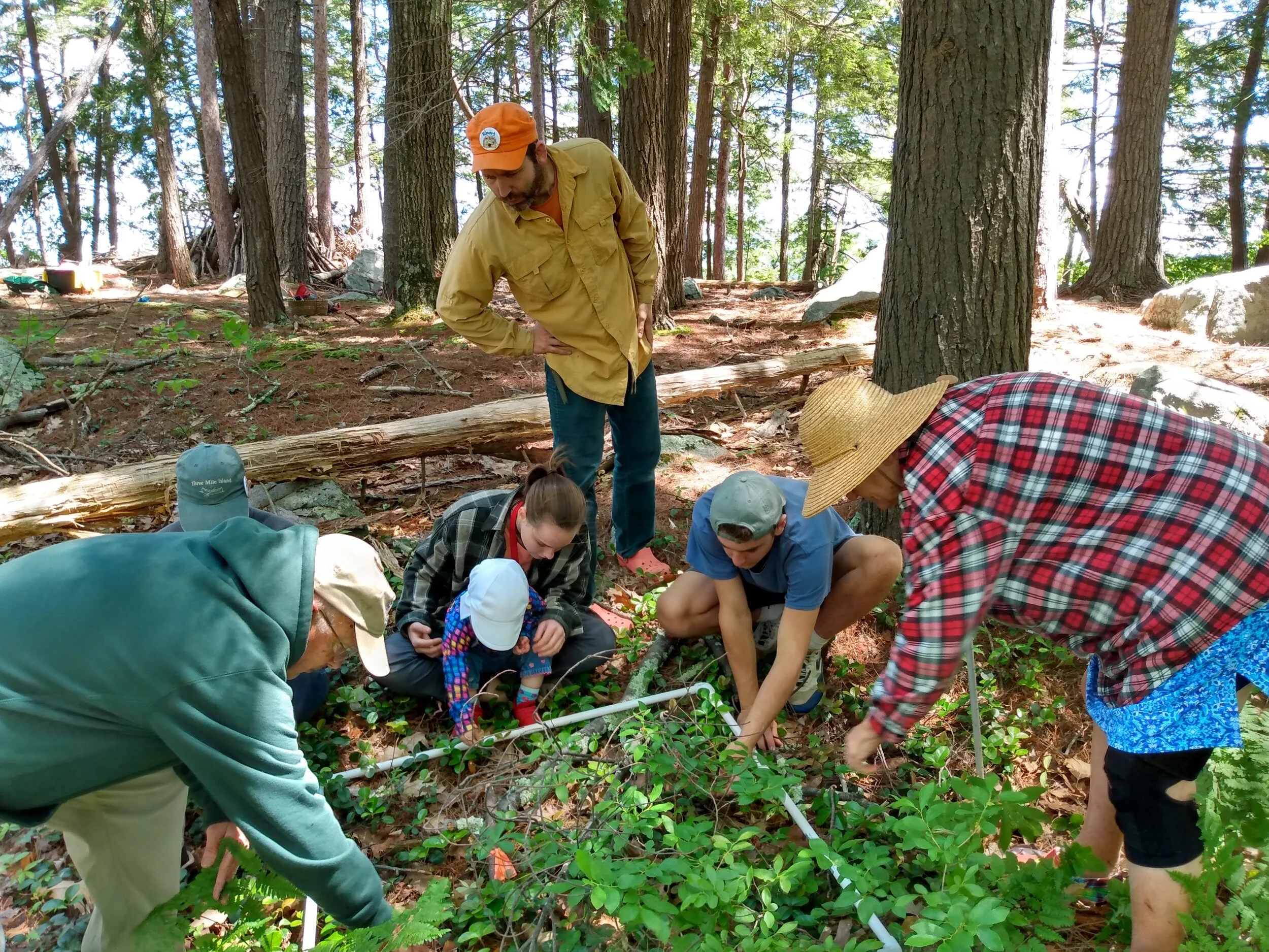
Volunteers inspect a vegetation plot during the June 2021 survey